
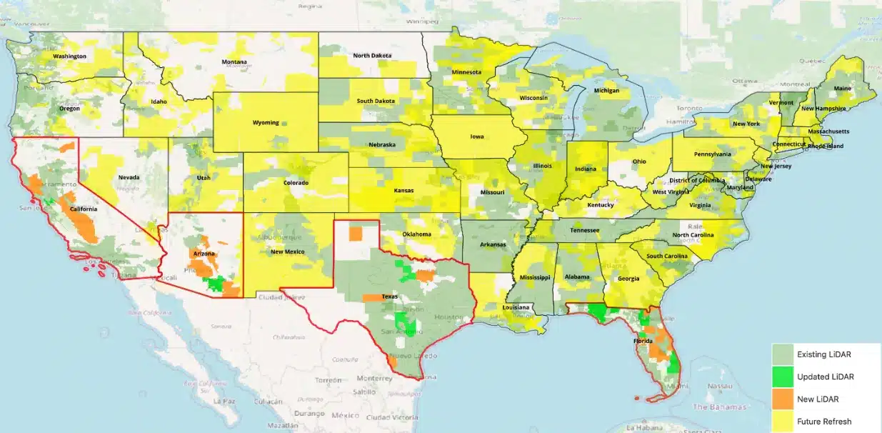
Solargraf has been leveraging innovative LiDAR data across the U.S. since 2021 to revolutionize solar design accuracy and efficiency. Our commitment to providing the best tools for solar installers continues with our latest update: a significant LiDAR data refresh for California, Florida, Texas, and Arizona. This enhancement expands our LiDAR data coverage in these key states by 166% and sets a new standard for solar design precision.
LiDAR, standing for Light Detection and Ranging, is a powerful technology that uses pulsed lasers to measure distances accurately. Imagine a highly detailed 3D map of a potential solar site, allowing you to account for every tree, building, and slope. That’s what LiDAR brings to your solar designs.
This update means Solargraf’s AI based shading engine can now detect roof, pitch, azimuth, trees, and other obstructions with even greater accuracy, leading to:
- Improved shading analysis: Precisely calculate the solar irradiance of different roof parts.
- Optimal panel placement: Identify the best spots for panel installation, enhancing system efficiency.
- Quicker, more accurate designs: Deliver superior proposals to your customers faster than ever.
We’re not stopping here. Our goal is to update LiDAR data for all U.S. states in the coming months, increasing our data accessibility by 1.5 times and expanding our reach to remote areas. Additionally, we’re excited to announce upcoming updates for international markets, including Germany and the Netherlands.
Optimize your solar designs with Solargraf’s cutting-edge LiDAR technology. Experience unmatched precision in solar design software today!
Stay ahead with Solargraf
Make sure you’re utilizing the full potential of our latest LiDAR data update. Dive into the new features, and don’t hesitate to contact our support team for assistance.
California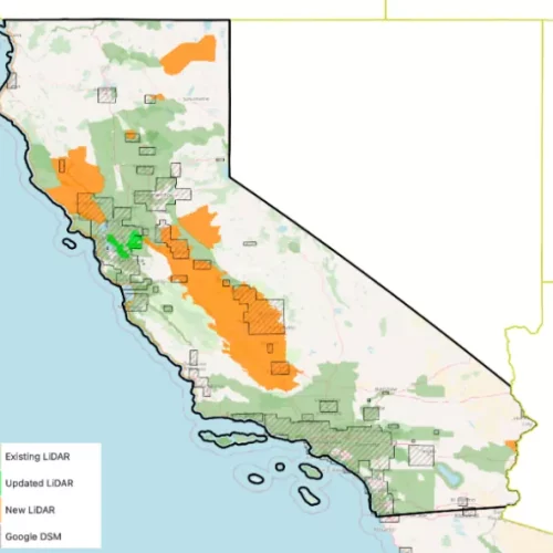
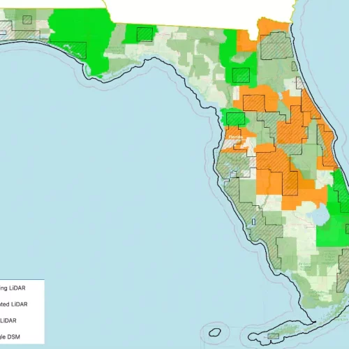
Florida
Texas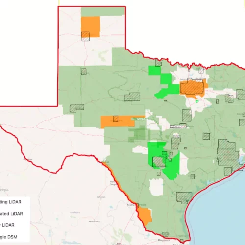
Arizona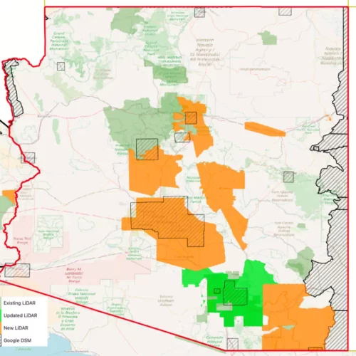
All of US by end of 2024
 United States
 Germany/Austria
 Brazil
 Netherlands
 Japan
Japan